
It’s finally happening. After weeks of sweltering heat and suffocating humidity, the Indian Meteorological Department (IMD) has confirmed that the monsoon is spreading rapidly across India, bringing both relief and disruption. From the lush coasts of Kerala to the bustling streets of New Delhi, a massive weather system is reshaping daily life for millions.
The southwest monsoon officially made landfall in Kerala on June 4, 2026. Since then, it hasn’t just stopped; it’s accelerated. As of mid-June, alerts are active in over 24 states. For residents in the north, this means a break from the deadly 'loo' winds. For those in the south, it’s a warning to brace for storms, lightning, and potentially dangerous flooding.
The Monsoon’s Rapid Northward Push
Here’s the thing about this year’s monsoon: it’s moving faster than expected. The IMD predicts that by late June, the rains will have covered most of the country. But the timeline isn’t uniform. It’s a staggered arrival that varies wildly by region.
In Bihar, meteorologists expect the monsoon to arrive between June 12 and 15. Eastern Uttar Pradesh is next up, with an estimated window of June 15 to 20. Western Uttar Pradesh might have to wait a bit longer, likely seeing entry between June 20 and 25. This progression suggests that while parts of the east are already feeling the cool breeze, the west is still baking in pre-monsoon heat.
But wait—there’s a twist. Alongside the traditional monsoon push, a new western disturbance is expected to reach northwest India around June 18. This unusual overlap could intensify rainfall patterns in regions like Punjab, Haryana, and Delhi-NCR, leading to more erratic weather than typical seasonal shifts.
Kerala and Tamil Nadu: Bracing for Impact
While the north waits, the south is already in the thick of it. Kerala and Tamil Nadu are facing severe weather conditions. The IMD has issued orange alerts for several districts in Kerala, predicting heavy to very heavy rainfall between June 4 and 9. In some spots, precipitation could hit between 7 and 20 centimeters.
This isn’t just rain; it’s a storm system. Authorities are warning of thunderstorms, lightning strikes, and gusty winds reaching speeds of up to 70 kilometers per hour. Local administrations have been put on high alert, urging residents to avoid unnecessary travel and secure loose structures. The combination of saturated soil and intense wind makes landslide risks significantly higher in hilly areas.
Tamil Nadu is experiencing similar conditions. Light to moderate rain is widespread, but isolated pockets are seeing heavy downpours. The Andaman and Nicobar Islands are also under watch, with moist winds driving consistent rainfall across the archipelago.
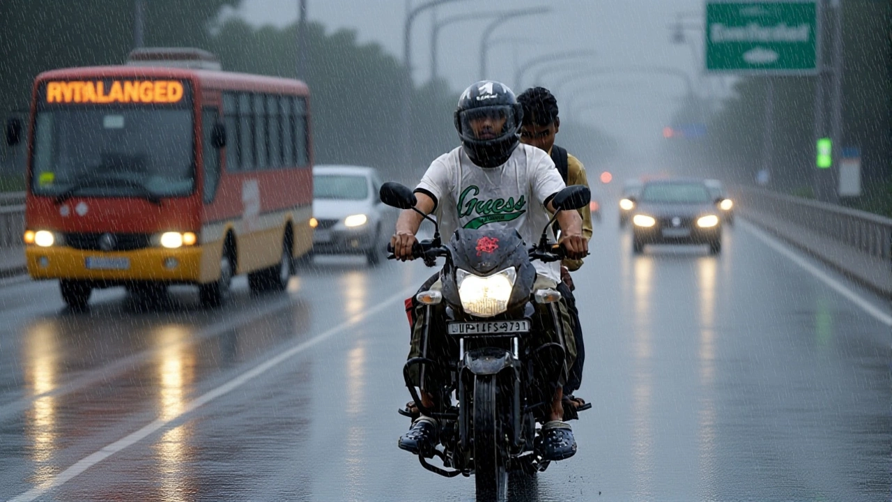
Delhi-NCR: A Break from the Heatwave?
For people in New Delhi and the National Capital Region, the news is mixed but largely welcome. The region has been grappling with a severe heatwave, with temperatures soaring well above average. However, the approaching monsoon front promises a significant drop in temperature.
Current forecasts suggest light to moderate rain accompanied by thunderstorms and strong winds in Delhi, Punjab, and Haryana. These aren’t full-blown monsoon rains yet—they’re pre-monsoon showers driven by the active weather system. Still, they’re enough to lower temperatures by several degrees, offering much-needed respite from the scorching sun.
Experts note that as the monsoon advances further north, these intermittent showers will become more frequent. By late June, Delhi could see regular rainfall, marking the true start of the rainy season for the capital. Until then, residents should stay prepared for sudden squalls and gusty winds, which can cause temporary power outages and traffic disruptions.
Broader Implications and Safety Concerns
The ripple effects of this weather pattern extend far beyond comfort levels. Agriculture, infrastructure, and public health are all at stake. Farmers in central and eastern India are hopeful that timely rains will boost crop yields, particularly for kharif crops like rice and cotton. However, excessive rainfall in Kerala and Karnataka raises concerns about waterlogging and potential damage to standing crops.
Infrastructure strain is another critical issue. Urban drainage systems in cities like Mumbai, Bengaluru, and Chennai are being tested early in the season. With climate change increasing the intensity of extreme weather events, urban planners are under pressure to upgrade flood management capabilities. The recent alerts serve as a stark reminder of these vulnerabilities.
Public health officials are also monitoring the situation. Post-rainfall outbreaks of dengue, malaria, and other vector-borne diseases are common. Communities are advised to eliminate stagnant water sources and use protective measures against mosquitoes. Additionally, the risk of respiratory issues increases during thunderstorms due to changes in air quality and pollen distribution.
What’s Next for the Coming Weeks?
The IMD indicates that the monsoon will continue its northward march over the next four to five days, strengthening its presence in Telangana, Odisha, Jharkhand, Bihar, and Chhattisgarh. This expansion is crucial for replenishing reservoirs and groundwater levels across peninsular India.
Meanwhile, the western disturbance affecting northwest India adds another layer of complexity. Meteorologists are closely tracking its interaction with the monsoon trough. If these two systems converge, it could lead to localized heavy rainfall in hill stations and northern plains. Residents in Himachal Pradesh and Uttarakhand should remain vigilant for landslides and flash floods.
In the short term, expect volatile weather. One day might bring sunshine, followed by intense storms the next. Flexibility and preparedness are key. Keep emergency kits ready, monitor local weather updates, and avoid traveling through low-lying or flood-prone areas during peak rainfall hours.
Frequently Asked Questions
When will the monsoon reach my state?
The timeline varies by region. Bihar expects arrival between June 12–15, Eastern UP between June 15–20, and Western UP between June 20–25. Kerala already received the monsoon on June 4. Check your local IMD forecast for precise district-level predictions.
Is the weather in Kerala dangerous right now?
Yes, several districts in Kerala are under orange alerts for heavy to very heavy rain. Winds up to 70 km/h and lightning pose significant risks. Avoid non-essential travel, especially in hilly areas prone to landslides, and follow local authority instructions.
Will Delhi get actual monsoon rain soon?
Delhi is currently experiencing pre-monsoon showers with thunderstorms. Full monsoon arrival is expected in late June. These early rains provide temporary relief from heat but come with gusty winds. Consistent rainfall will begin as the monsoon trough stabilizes over the north.
What is the "western disturbance" mentioned in reports?
A western disturbance is a weather system originating in the Mediterranean that affects northwest India. While typically a winter phenomenon, its presence in June alongside the monsoon can enhance rainfall and cause erratic weather patterns in Punjab, Haryana, and Delhi-NCR.
How should farmers prepare for this season?
Farmers should ensure proper drainage in fields to prevent waterlogging, which can damage roots. Monitor IMD advisories for timing sowing of kharif crops. In southern states, protect standing crops from wind damage using supports. Early harvest of mature crops is advisable if heavy rain is imminent.